Nasze Usługi

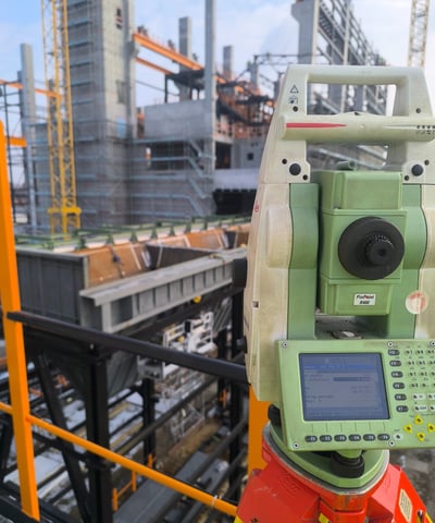
Oferujemy kompleksowe usługi geodezyjne w województwie pomorskim z wykorzystaniem nowoczesnego sprzętu.

Mapy do celów projektowych

Tworzymy mapy do celów projektowych, które są niezbędne w procesie budowlanym i planistycznym.

eyeglasses on map
eyeglasses on map
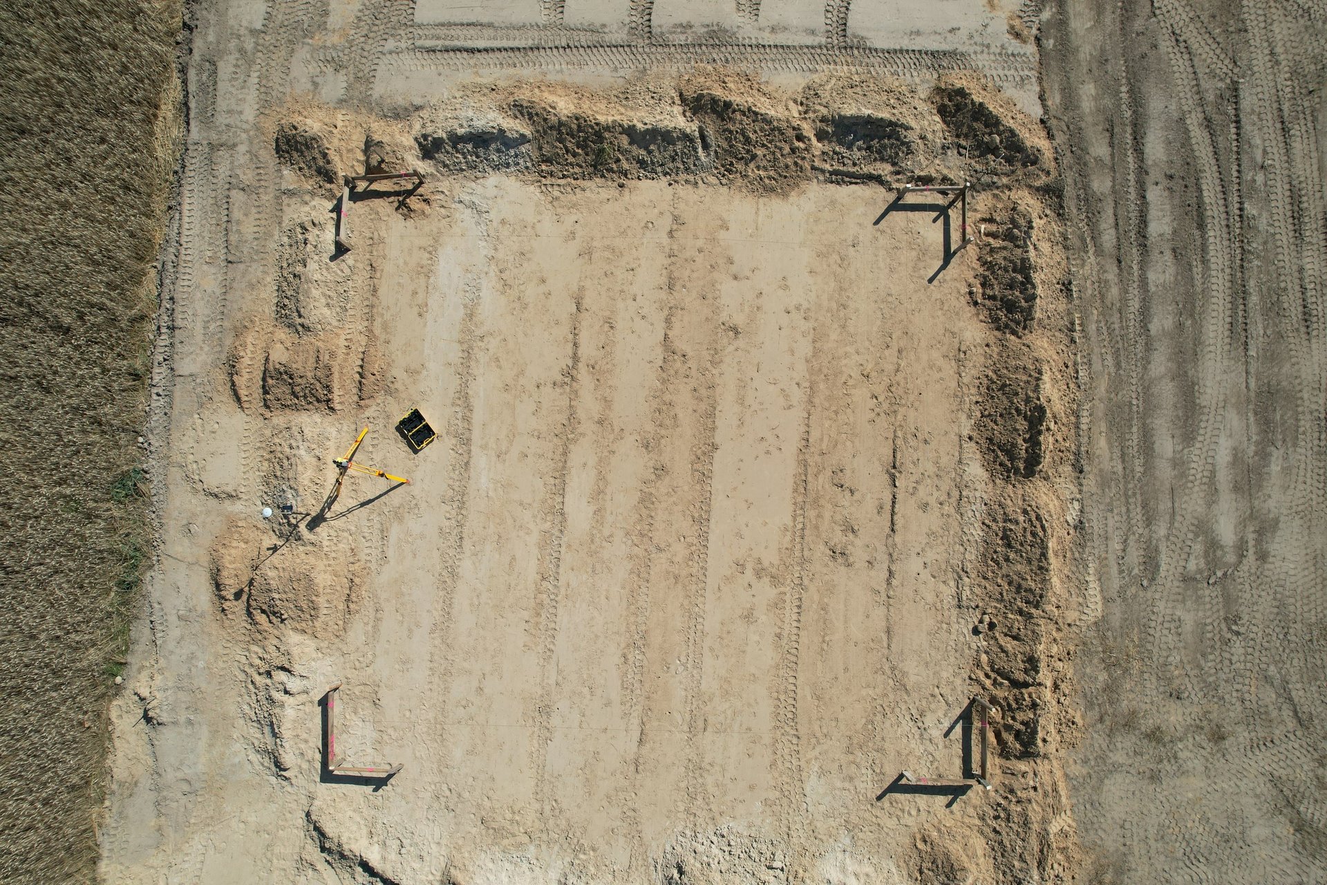
Tyczenie obiektów budowlanych

Wykonujemy tyczenie obiektów budowlanych oraz sieci uzbrojenia terenu zgodnie z obowiązującymi normami.

Nasze usługi obejmują inwentaryzacje obiektów budowlanych oraz sieci uzbrojenia terenu w regionie.

Inwentaryzacje obiektów
a construction site with a crane in the background
drafting instruments on top of table

O nas

Perfect-Geo to nowoczesna firma geodezyjna, oferująca kompleksowe usługi geodezyjne w województwie pomorskim z wykorzystaniem innowacyjnych metod pomiarowych.

A camera or surveying device is mounted on a tripod, facing a vast expanse of olive groves that stretch towards the horizon. The sky is overcast, contributing to a subdued atmosphere. A few scattered buildings are visible in the distance.

Nasza misja

Dążymy do zapewnienia najwyższej jakości usług geodezyjnych, wykorzystując nowoczesny sprzęt oraz profesjonalne podejście do każdego projektu i klienta.

A concrete survey marker embedded in a larger stone, featuring a round metal disc with engraved text from the U.S. Coast and Geodetic Survey. The marker is surrounded by soil and foliage, with sunlight casting shadows.